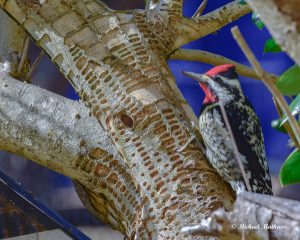
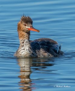
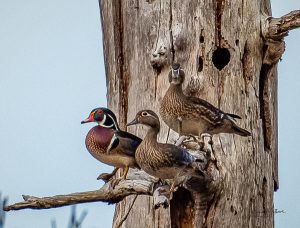
East Texas is blessed with a wide variety of ecosystems and habitats. This variety provides diverse wildlife communities that abound with a wealth of animal and plantlife. Texas has over 600 species of birds and more than half are found here in East Texas.
Here are some locations for you to use when planning your next birding trip.
 Bellwood Lake From loop 323 on the west side of Tyler, take Hwy 31 west, then make a left on Bellwood Lake Drive. Follow this to the lake and boat ramp on your right.
Camp Tyler Go south on 69 to 346 to Whitehouse, then turn left on 848 to 2127, there is a sign for Camp Tyler on 848. It is about a mile up the road. On 2127 before you get to Camp Tyler there is a branch of Lake Tyler. There is the yard of an old burned house that can be good birding. From the yard, you can scope the Lake. This area is often very good for ducks in winter. If you drive past Camp Tyler the road goes to a picnic area on Lake Tyler. This can be good birding. All along 2127, the birding is good in migration. Camp Tyler has a wooded area, meadows and fields, ponds, and Lake Tyler waterfront. It is great in winter and migration.
Camp Tyler is owned by a private foundation that has been very good about letting people bird. It is used primarily for youth activities for the schools and youth groups. You must sign a release form to bird. Call the camp office at 903-510-6406 Monday through Friday for permission. Forms may be downloaded from their web site The website for Camp Tyler is: http://wwwcamptyler.org
Dangerfield State Park From Tyler, take Hwy 155 north through Gilmer. Turn north on Hwy 259 to Daingerfield, then east on Hwy 11 to the park entrance, which is on the right. Admission to the state park is $3 per person.
Eastman Facility in Longview (prior coordination required) From Tyler. take I-20 east to exit 595a, Estes Parkway. Take a right at the stoplight onto Estes Parkway. Get in the left lane immediately. At the next set of lights from the left most turn lane go left on Estes drive. Estes Drive is on the interstate side, north side, of Walmart. Continue down Estes Drive until you see the Eastman sign. Turn left into the plant and continue on across the lake to the administration building, which is on the left. Bathrooms are not available at Texas Eastman. There is a Walmart at Estes Parkway and Estes Drive, where you turn at the stoplight to come down to the plant. Those who need a restroom break could stop there before arriving.
Eastman Mason Lake (Iron Bridge). From Tyler, take Broadway/Hwy 69 south and turn right on Cumberland. Go past the fields of Faulkner Park, then left into the park. The nature trail is on the right, just before a pond on your left. This is a 2-3 hr trip.
 Faulkner Park. From Tyler, take Broadway/Hwy 69 south and turn right on Cumberland. Go past the fields of Faulkner Park, then left into the park. The nature trail is on the right, just before a pond on your left. This is a 2-3 hr trip.
Gus Engeling WMA Gus Engeling is located on US 287 about 20 miles west of Palestine. Catfish Creek runs through it. This is a mixed forest area that is the beginning of the Post Oak Savanna. There are several nice trails, a pond, woodlands, and meadows. This is good in migrations. Prothonotary Warblers and Painted and Indigo Buntings nest here. It’s website is:
http://www.tpwd.state.tx.us/wma/wmarea/engeling.htm#top
John BunkerSands Wetland Center. From Tyler, take I-20 toward Dallas. Past Terrell, take FM741 south to Hwy 175. Take
175 west to the FM1389. This is approximately 90 minutes from Tyler.
Kurth Lake. From Lufkin, take HWY 59 North to Rivercrest road, approximately 1 mile north of Redland. Turn right (east) on Rivercrest and continue for 2 miles until you get to a railroad crossing. You will see the Kurth Lake sign and then turn left (north) on Kurth Lake road. After about 2 miles you will come to the entrance of the Kurth Lake Recreational area.
Lake Bob Sandlin. From Tyler, take Hwy 271 north to Pittsburg, then take loop 179 southwest to Hwy 11. Go right (west) on Hwy 11, then right (north) on Hwy 21. After you cross the lake, look for the signed entrance to the state park on your right. There are restrooms at the state park and by the dam. This is approximately 75 minutes and 68 miles from downtown Tyler.
Lake Fork. From Tyler, take US 69 north to Mineola. Continue north on state highway 37 to downtown Quitman (about 7 mi). Turn Left on state highway 154. Proceed 1 1/4 miles and then bear left on state highway 182. Go about 3 miles to the dam. This is about 37 miles from downtown Tyler.
Lake Murvaul. From Henderson, take Hwy 79 east to FM1970, then right (south) to Hwy 315, right (west) to FM1971, and left (south) on FM1971. Follow this till just before you reach Lake Murvaul. There is a small park to the left of the road by the lake. This is approximately 60 miles and 75 minutes from downtown Tyler.
Lake O’ the Pines. From north of Tyler, take Hwy 155 through Gladewater, then FM 726 east toward Lake O’ the Pines. Heading east on 726, take it onto the dam and turn left, down off the dam at the Lakeside Park sign. Then follow the road to the swimming beach at the east end of Lakeside Park.
Lake Palestine. From Tyler, take Hwy 31 West to Chandler and take FM315 south to Lake Palestine. After you cross the arm of the lake, turn left into a parking lot, head left and follow the narrow dirt road that goes out to the dry lake bed.
Lake Tawakoni. From Tyler, take I-20 west to exit 516 (FM 47) towards Will’s Point. Approximately 13 miles past Will’s Point you will pass CR 3708, then CR 3707, both of which go only to the left. Take the next left after CR3707 toward Holiday Marina and turn right soon after getting off FM47. This road dead-ends in the Van Zandt County boat ramp. This is 60 miles and approximately 70 minutes from downtown Tyler.
Lake Tyler Concession Area Go through Whitehouse on 346 to a small road that has a billboard for the marina and concession area. Turn left on that road. Turn into the Marina area. There is a parking lot. Across the road from the lot, there is a wooded area that is good birding in winter and migration. From the parking lot, scope the lake, there are usually ducks, terns, gulls, etc. on the lake in winter. Check out the boat ramp. Last year there was a Ross’s Goose, a white phase Snow Goose and a blue phase Snow Goose all winter. This is also a good place to scope the Lake.
Lake Wright Patman dam From Tyler, take Hwy 271 north to Hwy 155. Take that north to Hwy 59. Take Hwy 59 north, through Atlanta and Queen City and turn left onto Park Road (at the Wright Patman Lake sign) about 1 mile after crossing the Sulphur River. At the T-intersection, go left (south) and onto the dam to the headquarters parking lot. If you miss Park Road on Hwy 59 and reach FM2148, turn left, then left again at the Wright Patman Lake sign. This will put you on the dam. Follow the dam south to the parking lot. This is approximately a 2-hour drive from Tyler.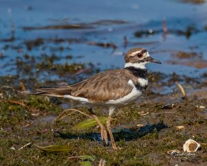
MINEOLA NATURE PRESERVE The 2,900-acre Preserve is on the Sabine River in East Texas. The park is open daily from 7 am to sunset. The Mineola Nature Preserve is just south of Mineola. >From Hwy 69: turn east onto Loop 564 then turn right onto CR 2724 (Cap Ranch Road); go 1.9 miles to the main entrance. From Tyler & I-20: Take Hwy 69 north past Lindale. Just after you pass the Sabine River, take the first right (Loop 564) and follow the signs to the Mineola Preserve. From Hwy 80 east of Mineola: travel south onto Loop 564 then turn left onto CR 2724 (Cap Ranch Road); go 1.9 miles to the main entrance. The website is http://www.mnpfriends.org/
Morris County Bottomland/Lake O’ The Pines From Tyler, take Hwy 271 north, then FM726 east, and Hwy 259 north to Ore City. This is approximately 55 miles and slightly more than 1 hrs drive from downtown Tyler. Most birding will be done by the roadside, within short walks from the cars.
Old Sabine Bottoms WMA Is 5 miles north of Lindale off CR.. 4106. Take 2710 to 4128 to 4106. There is a map on the website. This is particularly good in April when Prothonotary and Northern Parula are breeding. It’s also good for butterflies. The website for Old Sabine WMA is: http://www.tpwd.state.tx.us/wma/wmarea/sabine .
Pleasant Hill Area. From Longview, go east on I 20 to Exit 604 (Hallsville/ FM 450). Turn right (south) on FM 450 and follow 1.5 miles to FM 968. Turn left (northeast) on FM 968. After 1.9 miles, look for the “Pleasant Hill Cemetery” sign and turn right on Hut Horton Road. A 1.7-mile access road leads to the Pleasant Hill Cemetery. We will meet here at 8 am and will bird until around noon. The nearest bathroom facilities are at a Shamrock gas station on FM450 just north of I-20.
Red Slough NWR. The Red Slough NWR is just across the Texas-Oklahoma border, north of De Kalb, Texas (about 2 hrs from Longview). From De Kalb take US 259 north. Turn right (east) on Oklahoma 87 and go about 3 miles. Look for the Getty Oil sign and turn left (north) onto Mudline Road.
 Richland Creek WMA Richland Creek WMA is in Freestone and Navarro counties, about 10 miles west of Gus Engeling and approximately 75 minutes drive from Tyler. The north unit is off Hwy 287, near the junction with FM488, southwest of Athens. The south unit is off FM 488, near the junction with Hwy 287. There is a sign for the North Unit just before you get to the Richland Chambers Lake dam. This area is a freshwater marsh that is owned by the Tarrant County Water Authority. It is excellent in migration. Many shorebirds and wading birds come through in migration. Wilson’s Phalaropes are found there each year. The willows along the road can be very good for migrants. Dickcissels, and Buntings nest there. It’s website is:
http://www.tpwd.state.tx.us/wma/wmarea/richland.htm#text
Everyone who enters the WMA must have a limited public use permit ($12 per year). These can be purchased where hunting and fishing licenses are sold, e.g. Wal-Mart. There are no food or restroom facilities in the WMA.
Rose Rudman Park Go south on 69 to South Loop 323 and turn left onto s. Loop. Turn right at first light (Donnybrook). On weekends you can park in R. E. Lee parking lot. The park begins across from the R. E. Lee campus and follows a creek. There is a paved walk on the west side of the creek. If you take the little spur off the walk to the east you can cross the creek. On the east side of the creek, a trail runs along the creek. This area is more natural than the west side. Both sides can be good. Be sure to go to the southern part of the park under the big oaks. This can be very productive in winter and migration.
Texas Fresh Water Fisheries Take FM 2495 Southeast from Loop 7 (formally Loop 317) which circles the city of Athens, Texas. When you cross the bridge turn in at the Public Boat Ramp sign. The Ramp is adjacent to the Freshwater Fisheries facility, about 5 miles from downtown Athens. www.tpwd.state.tx.us/spdest/visitorcenters/tffc/
Tyler State Park Take 14 north of Tyler to the Park Road. Throughout the Park, there are a number of trails. The most productive is the trail that circles the lake. In winter and migration check out the area around the Concession. Take the trail to the left following the lake. On the far end, there is a swampy area that is particularly good. Follow the trail over the bridge and around to the dam. the backside of the dam is good for sparrows in the winter. This Park is very busy on holidays and Summer. The website for TSP is: http://www.tpwd.state.tx.us/park/tyler/tyler.htm